Steps to get the WMTS url of a dataset
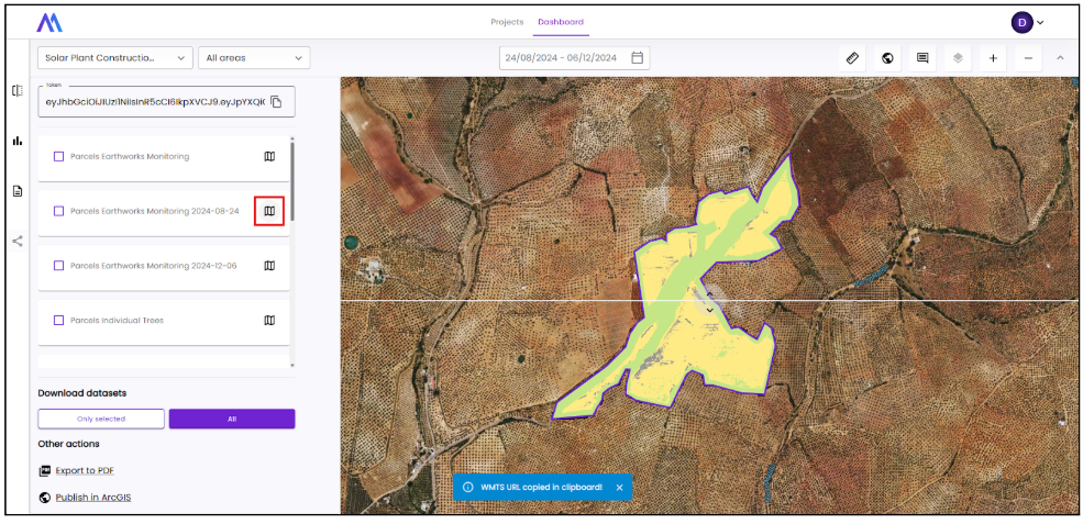
1 - Go to Dashboard page, select project and desired dates and click on “Sharing” icon:
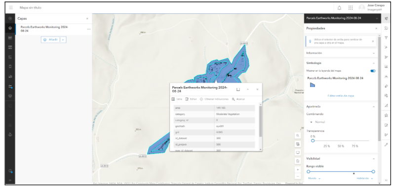
2 - Click on the map icon on the right side of the card for the desired dataset’s WMTS to copy it to your clipboard:
Steps to publish a dataset in ArcGIS
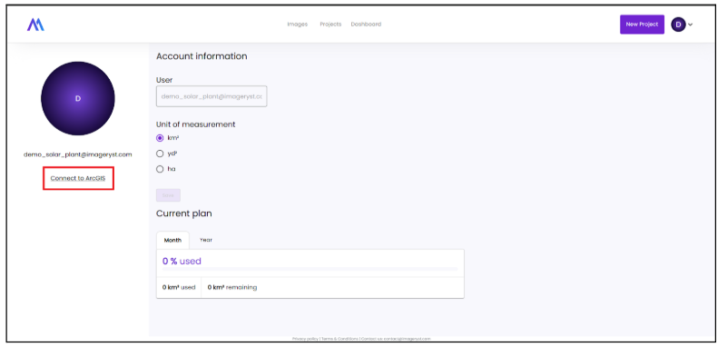
1 - Log In to ArcGIS platform from user profile page:
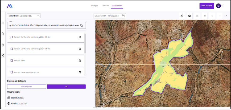
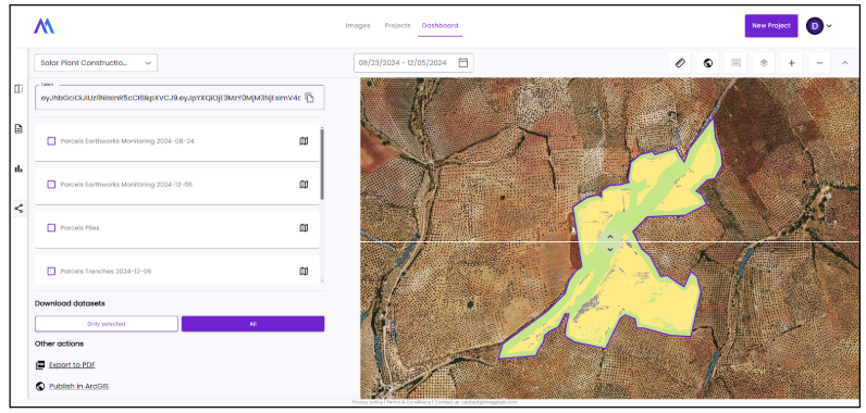
2 - Go to Dashboard page, select project and desired dates and click on “Sharing” icon:
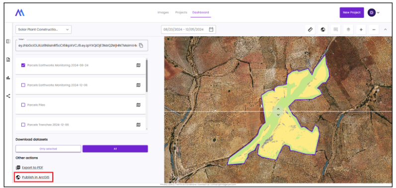
3 - Select the dataset or datasets to publish and Click on ‘Publish in ArcGIS’
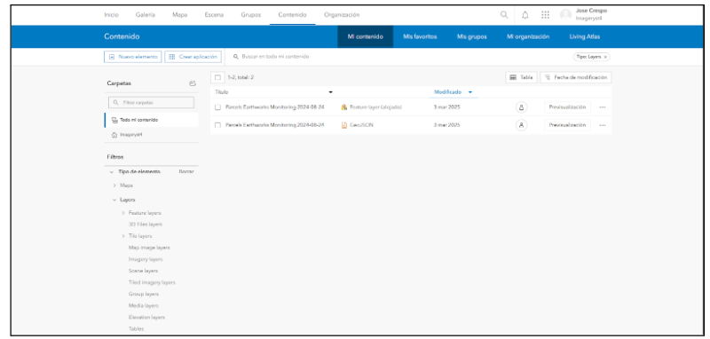
4 - If upload is successful, we can look for our datasets in ArcGIS:
5 - And watch the results in the ArcGIS Map viewer:
Steps to show WMTS layer on ArcGIS Pro
1 - Login to your ArcGIS Pro account
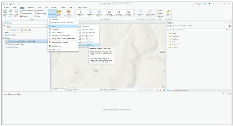
2 - Click on Insert -> Connections -> Server -> New WMTS Server
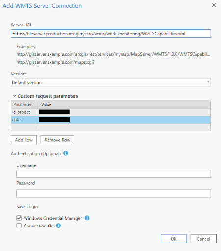
3 - Insert our WMTS service url and extra parameters (id_project and date)
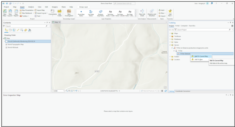
4 - Select the imported WMTS Layer (Right click on the layer and click on Add To Current Map)
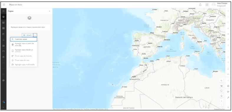
Steps to show WMTS layer on ArcGIS online
Once we have logged in to ArcGIS web:
1 - Go to Map viewer tool
2 - Click on ‘Add Layer’ side button and ‘Add layer from URL’
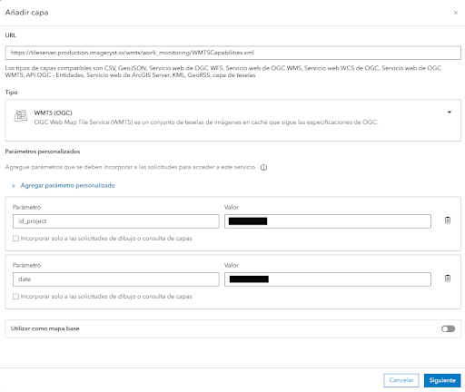
3 - Insert our WMTS URL and add the project id and date in extra parameters.
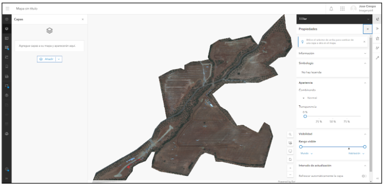
4 - View WMTS of the selected dataset
Steps to show WMTS layer on QGIS
Open QGIS, and then:
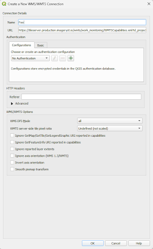
1 - Right click on WMS/WMTS option -> New connection…
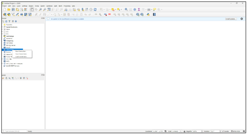
2 - Insert a name for the connection (optional) and the url of our service
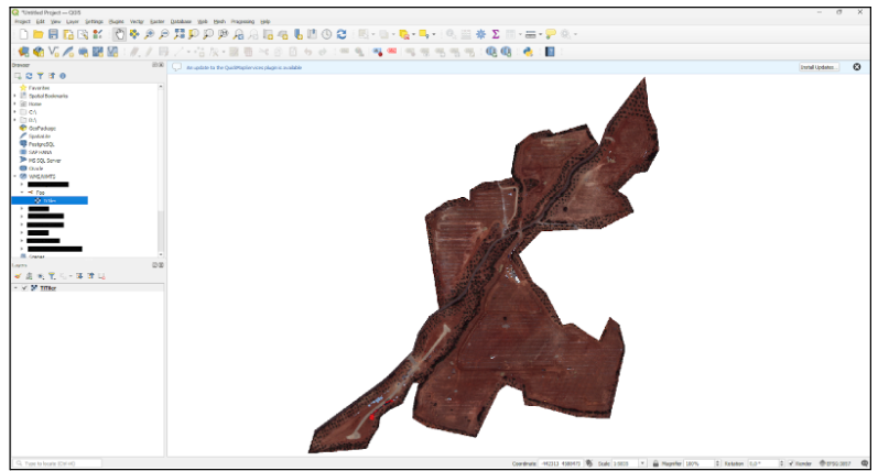
3 - Load the layer selecting it under WMS/WMTS-> <Name of the connection> -> TiTiler
Steps to show datasets In ArcGIS Pro
1 - Login in your ArcGIS Pro account
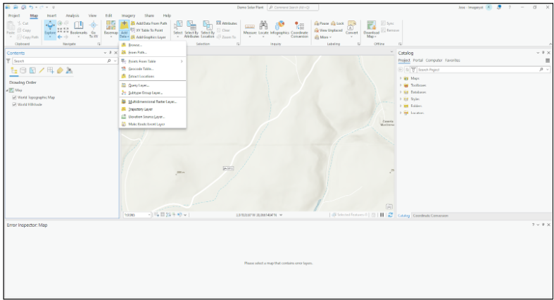
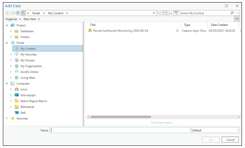
2 - Click on Map -> Add data -> Browse…
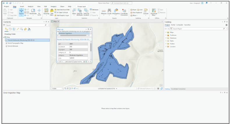
3 - Inside My content, select the layer we want to see in ArcGIS PRO
4 - View your data
Steps to show datasets In ArcGIS Online
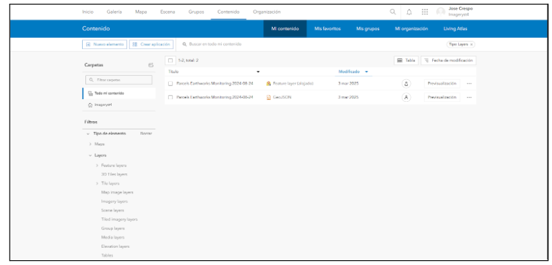
1 - We can look for our datasets in the tab Content of ArcGIS Online
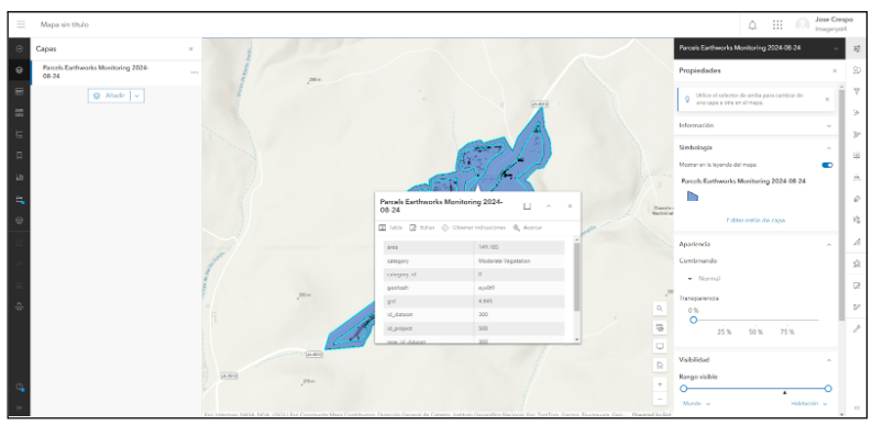
2 - And watch the results in the ArcGIS Map viewer
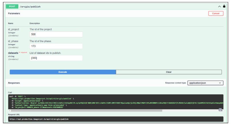
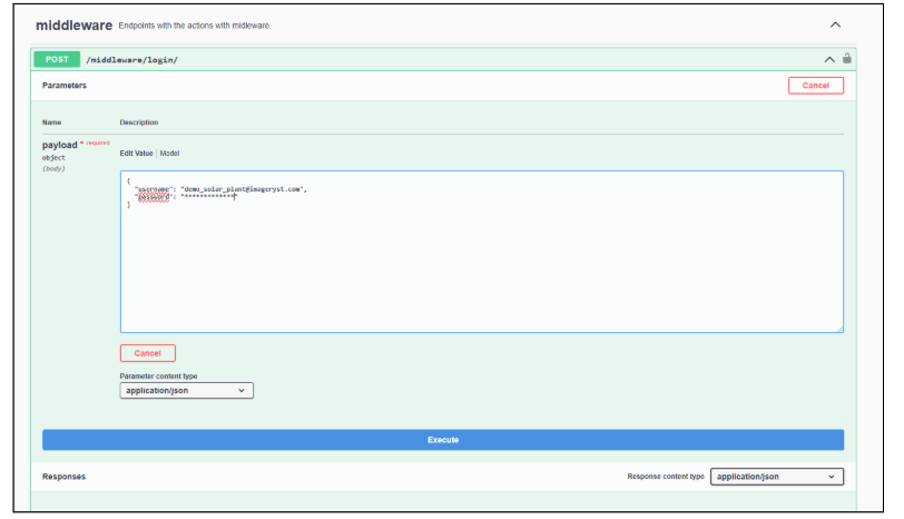
Steps to Publish dataset via Imageryst API
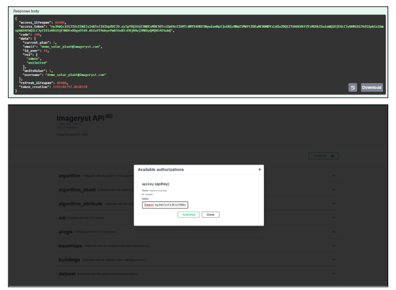
1 - Authenticate in our API (https://api.production.imageryst.io/api/v1/)
2 - Copy access token and add it to Authorize (Adding Bearer before it)
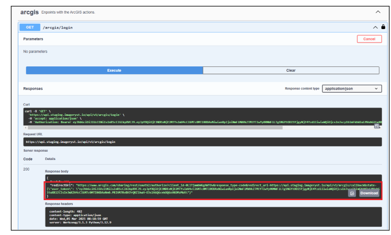
3 - Select the arcgis endpoint and use /login to generate ArcGIS Authentication tokens
3.1 - If user hasn’t logged in before, we need to copy the redirectUrl in a new tab and log in to ArcGIS
3.2 - Otherwise, if the user has already logged in, it will only refresh the token.
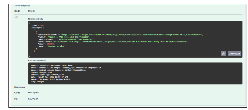
4 - Select /publish and insert the data of the dataset or datasets we want to upload: